EXCLUSIVE: Arizona’s Maricopa County Had GIS Election Mapping Capabilities Providing Up-to-Date Information on Ballots Processed at Any Time

Maricopa County has a GIS election system that the up-to-date status of votes at any time. Could this have been used to record and manipulate vote results?
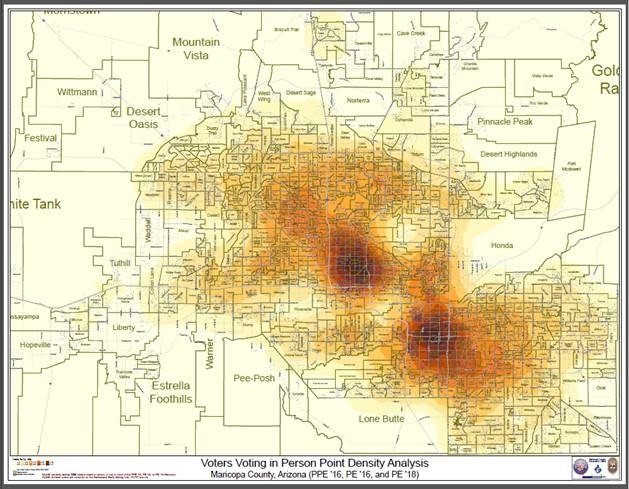
Maricopa’s real-time visibility into ballots is just mind-boggling. It doesn’t just recognize when completed ballots are received. It can map every voter location for ballots that have passed the signature verification process. This is a true reflection of what will be tabulated. It can show areas of low or high turnout, by party, Spanish-only ballots, or just about any other criteria. Their public interactive map currently shows 2020 returns by precinct, political party, and demographics including race and age. The (UOCAVA) map of overseas voters shows the entire world including China (145 votes),


