Top Secret U.S. Underwater Drone Weapon ‘Manta Ray’ Discovered on Google Maps


A top-secret U.S. underwater drone called the “Manta Ray” has been discovered on Google Maps.
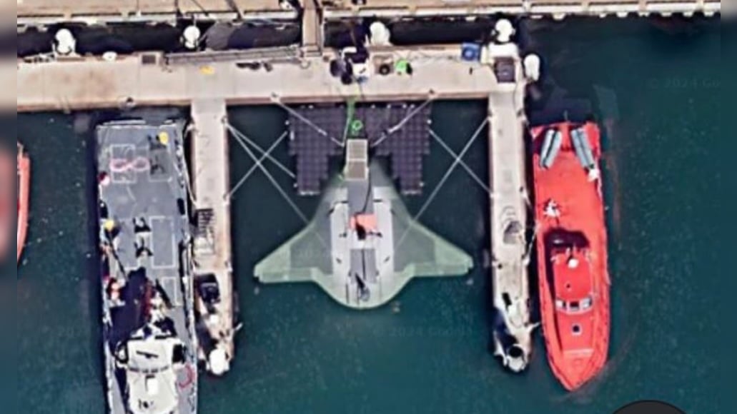
Satellite photos on Google Earth show the Manta Ray docked at the Port Hueneme naval base in California.
As The Gateway Pundit previously reported, the Defense Advanced Research Projects Agency (DARPA) tapped defense contractor Northrop Grumman to create a prototype of the Manta Ray.
According to DARPA’s site, the Manta Ray seeks “to demonstrate innovative technologies allowing payload-capable autonomous unmanned underwater vehicles (UUVs) to operate on long-duration, long-range missions in ocean environments without the need for on-site human logistics.”
LOOK:
Someone managed to find the DARPA Manta Ray on google maps
Coordinates
34°09’12″N 119°12’31″W pic.twitter.com/uMdDj2dMsO
— nikola 3 (@ronin19217435) June 20,


